|
|
|
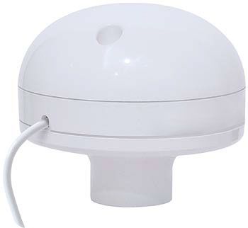
Deluo 38-012-05 GPS Marine Navigation Kit, 12 channel, -165dBW (minimum) Sensitivity, 15m CEP Accuracy Position, 0.1m/sec Velocity; Time: ± 1ms; WAAS Accuracy Position: 5m CEP; Velocity: 0.05m/sec; Acquisition time Cold start: <120sec; Warm start: <45sec; Hot start: <15sec; Reacquisition: <100msec; Dynamics Altitude: -1000m to +18000m; Velocity: 500m/sec; Acceleration: ±4g; Dimension Diameter: 83mm; Height: 60mm; Weight: 240 gr.
|
General
Information |
|
Manufacturer |
Deluo |
|
Manufacturer
Part Number |
38-012-05 |
|
Product
Line |
GPS |
|
Product
Name |
38-012-05 |
|
Marketing Information |
Turn your PC, Laptop, or PDA into a Chart
Plotter!
FUGAWI Marine ENC is a full-featured program for turning your PC, laptop,
or PDA into real-time GPS chart plotter. FUGAWI Marine ENC lets you
preplan trips and print maps from your home computer, up and download
waypoints, routes and tracks from your handheld GPS, or navigate in
real-time on your computer screen or PDA. This Marine GPS Navigation
System includes a Deluo Marine Smart-Antenna GPS Receiver and the full-featured
Marine Navigation software, FUGAWI Marine ENC.
Widest selection of Digital Charts Best of all, FUGAWI Marine ENC will
load the widest variety of digital maps and charts including the new
free-of-charge NOAA ENC vector marine charts, any nautical BSB chart (MAPTECH,
SoftChart, NDI Digital Ocean), NOAA Planning Charts, USGS DRG’s, Chart
Tiff, and many more. You can even build your own digital chart kit by
scanning your own paper charts. With FUGAWI Marine ENC, you are not
limited to using charts from a single manufacturer; this provides you
with the widest possible range of charts from which to choose.
Control your autopilot:
If you have an autopilot, FUGAWI Marine ENC will export the NMEA data
needed to drive it. |
|
Specifications |
|
GPS |
- Receiver: L1 1575.42MHz, C/A code, 12-channel,
Carrier-Aided with HWTrack
- Sensitivity: -165dBW (minimum)
- Accuracy
- Position: 15m CEP
- Velocity: 0.1m/sec
- Time: ± 1ms
- WAAS Accuracy
- Position: 5m CEP
- Velocity: 0.05m/sec
- Acquisition time
- Cold start: <120sec (typical)
- Warm start: <45sec (typical)
- Hot start: <15sec
- Reacquisition: <100msec
- Dynamics
- Altitude: -1000m to +18000m
- Velocity: 500m/sec
- Acceleration: ±4g
- Dimension
- Diameter: 83mm
- Height: 60mm
- Weight: 240 gr
USB adapter for Laptop/PC included. No
extra power source needed. |
|
Minimum Requirements |
- Windows 2000 or XP
- 500 mhz processor or better
- 256 mb RAM
- 256 color display or better
- 500 mb on hard drive
- Mouse or other pointing device
- Available USB port
- DVD drive for Bonus Data Pack
- Program provided on CD
|
|
Package Contents |
- 1 Deluo Marine GPS
- 1 USB adapter for Laptop/PC
- 1 Fugawi Marine ENC v4.0
|
A-20070215-1439-116-E
*This item is BRAND NEW -
not refurbished. It comes with all manufacturer supplied accessories, and full
manufacturer's USA warranty. |

